Jhelum waters start to recede
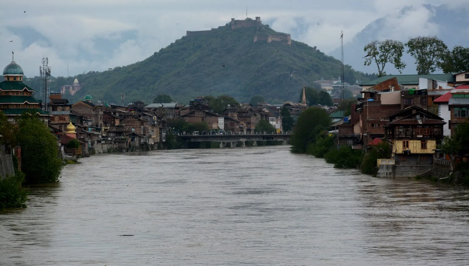
Following the incessant rainfall that wreaked havoc across Kashmir for the past three days, the water levels at Ram Munshi Bagh and Pampore gauges which reached the flood declaration mark on Tuesday morning have started to recede now.
At the same time, in a sigh of relief for the people, especially those living in low-lying areas, rains stopped on Tuesday and the Meteorological Department (MeT) forecasted cloudy weather with the possibility of scattered fresh rains.
Chief Engineer of the Irrigation and Flood Control (I&FC) Department in Kashmir, Naresh Kumar reassured that while the water level in the River Jhelum at Sangam in south Kashmir had started to recede, a rising trend was observed in the central part of the Jhelum, expected to last for a few more hours before receding.
“The peak water volume from south Kashmir has already reached central water bodies in Kashmir,” Kumar said. “Although the water level at Ram Munshi Bagh and Pampore had crossed the flood declaration mark, now the water level is receding.”
The data from I&FC Kashmir indicated that Pampore was flowing at 1587.524 meters, while Ram Munshi Bagh recorded 18.15 feet.
Both water bodies showed a downward trend after crossing the flood declaration mark on Monday.
According to the I&FC Department, areas like Wular, Batkoot, and Asham continued to witness an upward trend in water levels despite the River Jhelum at Sangam receding to 16.94 feet at 2 pm.
The MeT issued an update for Jammu and Kashmir, indicating a change in weather patterns over the coming days.
In the past 24 hours, J&K experienced light to moderate rain and snow in higher reaches, with heavy rain and thunder reported in some areas.
WATER LEVELS RECORDED AT 7 PM ON APRIL 30, 2024
The water level of River Jhelum at Sangam was recorded at 14.92 feet, below the danger mark of 21 to 25 feet; at Pampore at 4.48 meters, below the danger mark of 4.5 to 5 metres; at Ram Munshi Bagh at 17.49 feet, below the danger mark of 18 to 21 feet; at Asham at 11.77 feet, below the danger mark of 14 to 16.5 feet; and at Wullar at 1577.51 meters.
The water level in tributaries including Vishow Nallah at Khudwani was recorded at 4.88 meters, below the danger mark of 7.75 to 8.5 metres; Rambiyara Nallah at Wachi was 0.82 meters, below the danger mark of 5.4 to 5.7 metres; Lidder Nallah at Batkoot was 0.30 meters, below the danger mark of 1.5 to 1.65 metres; Doodhganga Nallah at Barzulla was 1.36 meters, below the danger mark of 3.65 to 3.8 metres; and Sindh Nallah at Doderhama was 1.57 meters, below the danger mark of 3.65 to 3.9 metres.
FORECAST
For April 30, the MeT had forecast generally cloudy conditions with light rain and thunder in many places.
From May 1 to 5, it has predicted generally dry weather with afternoon and night thundershower activity in a few places.
From May 6 to 7, the MeT has predicted light rain with thunder at scattered places.
ADVISORIES
The farmers have been advised to resume farm operations from May 1.
Temporary disruption of traffic is expected over higher reaches of Zojila Pass, Sinthan Pass, Razdan Pass and Mughal Road.
There is also a possibility of landslides and shooting stones at a few vulnerable places.
The MeT advised residents and authorities to stay updated with the latest weather forecast and take necessary precautions.
As a precautionary measure, the University of Kashmir and schools across various districts including Srinagar, Kupwara, Doda, Gurez, Ramban, and Bandipora remained closed on Tuesday.
Efforts were underway to clear waterlogged roads in Srinagar with the city centre already cleared and work ongoing for the bylanes.
However, the Srinagar-Jammu National Highway remained closed for restoration work along with other roads like the Srinagar-Sonamarg Road, Mughal Road, and Bhaderwah-Chamba Road due to the accumulation of snow.
PRECIPITATION
The MeT officials said that the rainfall recorded in the past 24 hours till 8:30 am on Tuesday in Srinagar was 23.6 mm, Qazigund 40.2 mm, Pahalgam 41.6 mm, Kupwara 19.8 mm, Kokernag 35.8 mm, Gulmarg 21 mm, Jammu 20.6 mm, Banihal 60.6 mm, Batote 40.2 mm, Katra 30.6 mm, and Bhadarwah 21.8 mm.
TEMPERATURES
Regarding minimum temperatures, the MeT officials said that Srinagar recorded a low of 3 degrees Celsius, 6.3 degrees Celsius below normal.
Qazigund recorded a minimum of 3.8 degrees Celsius, 4 degrees Celsius below normal.
Pahalgam recorded a low of 0.7 degrees Celsius, 3.7 degrees Celsius below normal.
Kokernag recorded a minimum of 2.6 degrees Celsius, 5.5 degrees Celsius below normal.
Kupwara town recorded a maximum of 3.6 degrees Celsius, 4.2 degrees Celsius below normal.
Gulmarg recorded a minimum of minus 1.5 degrees Celsius, below normal by 5.7 degrees Celsius.
Jammu recorded a low of 12.9 degrees Celsius, below normal by 9 degrees Celsius.
Banihal recorded a low of 5.2 degrees Celsius, Batote 6.5 degrees Celsius, and Bhaderwah 5.6 degrees Celsius.
Recruitment in Government Polytechnic for Women, Jammu
Job Recruitment in Ministry of Textiles
Job Recruitment in Baba Ghulam Shah Badshah University
Various Job Recruitment in IUST